

The Geospatial Revolution: A Comprehensive Review of Artificial Intelligence Integration
Author: Dr. Saeed Javizadeh, Spatial Intelligence and GeoAI Strategist
saeedjavizadeh@gmail.com
989120438874

“Spatially explicit GeoAI models, which integrate location and domain-specific spatial concepts into artificial intelligence, are crucial for advancing geographic knowledge, outperforming traditional non-spatial methods in tasks from image classification to urban climate analysis.”
Chapter Learning Objectives:
- To understand the foundational principles and synergistic nature of Geospatial Artificial Intelligence (GeoAI).
- To explore the diverse and impactful applications of GeoAI across various sectors, including agriculture, urban planning, environmental monitoring, and disaster management.
- To identify the key technological and ethical challenges inherent in the development and deployment of GeoAI solutions.
- To recognize the essential hardware and software components that enable high-performance GeoAI operations.
- To consider the future prospects and emerging research directions that will shape the evolution of GeoAI and its societal contributions.
Abstract
Geospatial Artificial Intelligence (GeoAI) represents a transformative paradigm at the confluence of Artificial Intelligence (AI) and geospatial data science. This chapter provides a comprehensive review of GeoAI, elucidating its definition as a synergistic concept that applies AI methods and models to geospatial information. It delves into the extensive array of GeoAI applications, showcasing its utility in critical domains such as precision agriculture, urban planning, environmental monitoring, water resource management, disaster management, and public health. Furthermore, the discussion addresses the significant challenges impeding GeoAI’s progress, including issues related to data quality, computational demands, model interpretability, bias, and privacy. The chapter also explores the essential hardware and software frameworks supporting GeoAI development and concludes with an outlook on future prospects, emphasizing the need for new architectural designs, enhanced explainability, the integration of Internet of Things (IoT), and the establishment of industry standards to foster a more responsible and impactful GeoAI ecosystem.
Introduction
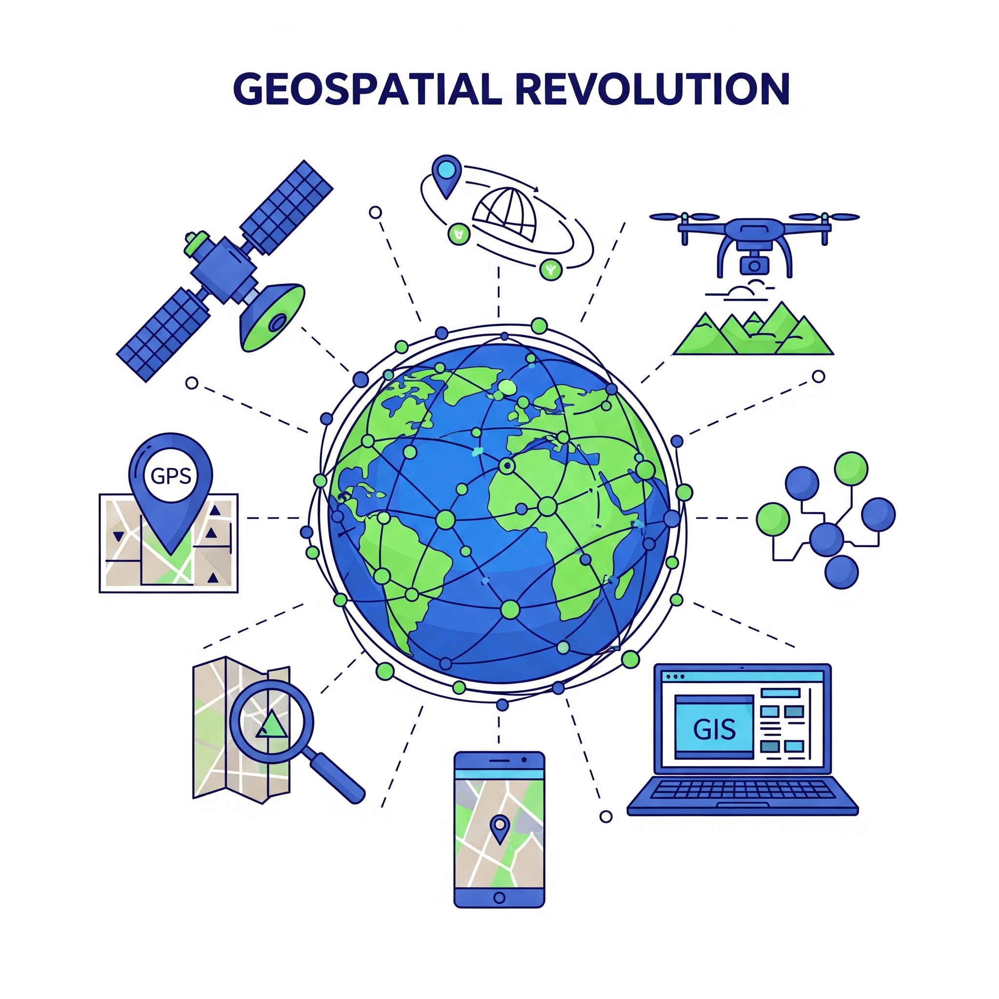
In recent decades, both Artificial Intelligence and geospatial information have independently emerged as powerful forces reshaping various aspects of human endeavor. Artificial Intelligence, with its capacity to emulate human cognition, analyze vast and complex datasets, automate intricate processes, and facilitate critical decision-making, has instigated radical transformations across sectors ranging from healthcare and finance to commerce and transport. Its algorithms enable unprecedented precision in tasks such as medical image analysis for tumor detection, optimization of renewable energy production, and prediction of consumer demand. Concurrently, geospatial information has profoundly impacted daily life, enabling precise navigation, location identification, and route finding in diverse environments. Geospatial technologies are also at the forefront of advanced fields like agriculture, environmental science, defense, urban planning, and public health, offering a unique dimension of analysis by integrating data from various acquisition systems, including satellites, drones, and GPS receivers.
The convergence of these two influential domains has given rise to Geospatial Artificial Intelligence, or GeoAI, a synergistic concept that applies AI methods and models to geospatial data. GeoAI is rapidly gaining traction in both research and industrial applications, promising to unlock deeper insights from massive and complex geospatial datasets and to perform sophisticated tasks with high accuracy. This integration is particularly crucial for addressing today’s global challenges, participating in the era of digital transformation, and ensuring sustainability and global development. This chapter aims to provide a thorough overview of GeoAI, exploring its fundamental principles, diverse applications, inherent challenges, and promising future trajectories, while underscoring its close relationship with Geographic Information Systems (GIS) and large-scale geospatial data, often referred to as big geodata.
Defining Geospatial Artificial Intelligence and its Foundations
Geospatial Artificial Intelligence is fundamentally a synergistic concept that integrates Artificial Intelligence methods and models with geospatial data. This fusion is not merely an aggregation of two technologies but rather a deeper correlation between AI capabilities and the unique characteristics of the geospatial domain. GeoAI aims to leverage AI’s analytical power to manage and exploit geospatial information, opening a new era of interpretation, especially for complex and massive datasets. Its development is closely tied to established concepts such as Geographic Information Systems, which provide the framework for managing and analyzing spatial data, and big geodata, referring to the large-scale, diverse, and complex geospatial datasets that modern AI techniques are uniquely suited to process.
A key aspect of GeoAI lies in its “spatially-explicit” nature, which distinguishes it from generic AI applications. Spatially-explicit GeoAI models are designed to inherently account for the spatial dimension, ensuring that the results are not invariant if the studied issues are relocated, and that spatial representations, relations, and concepts are integral to the algorithms’ formulations. Furthermore, the input spatial structures must demonstrably differ from the output, signifying a genuine spatial transformation. This intrinsic understanding of location and spatial context allows GeoAI models to outperform traditional non-spatial machine or deep learning models in various geography-related tasks, including image classification, geographic knowledge graph summarization, terrain feature detection, urban ecology, and climate studies. The contemporary development of GeoAI predominantly focuses on deep neural network-based approaches, reflecting the broader trend in AI research.
Diverse Applications of GeoAI Across Key Sectors
GeoAI’s transformative potential is evident in its wide array of applications across numerous critical sectors, offering innovative solutions to complex real-world problems.
Precision Agriculture
In agriculture, GeoAI is revolutionizing practices by enabling data-driven decisions that optimize resource use and increase crop yields. This includes predictive mapping of agricultural crops, where satellite imagery of varying resolutions, historical crop maps, and ground truth data are used to classify crops with high accuracy. This technique is vital for evaluating the impact of drought and climate change on agricultural production and identifying potential yields. GeoAI models like Random Forest classifiers and regressors, Multilayer Perceptrons (MLP), Support Vector Regression (SVR), and Deep Neural Networks are employed to predict yields by exploiting diverse data sources. These sources include indicators from Sentinel-2 satellite images, Real-Time Kinematic (RTK) GPS, Light Detection and Ranging (LIDAR) data, Landsat-8 satellite data converted to Normalized Difference Vegetation Index (NDVI), and agro-meteorological data. Unmanned Aerial Vehicle (UAV) imagery, particularly RGB and Thermal Infrared (TIR) images, further enhances yield estimation by providing high-accuracy phenotypic characteristics of crops, such as wheat spikes, which are extracted using models like Region-based Convolutional Neural Networks (R-CNN).
Beyond crop mapping and yield prediction, GeoAI significantly contributes to precision irrigation, optimizing water resources by integrating modern technologies. Models like Mask-RCNN, often with ResNeXt backbones, are used for automatic detection of Center Pivot Irrigation Systems (CPIS) from time series of Sentinel-2 satellite images, adaptable to different environmental conditions. U-Net segmentation models combined with transfer learning are applied for regional irrigation system segmentation using aerial images. Additionally, intelligent systems leverage RGB and TIR images from drones, alongside GPS data, to identify and selectively irrigate the driest areas, adjusting water flow with AI components like Random Forest.
Urban Planning, Logistics, and Transport
GeoAI provides productive solutions for urban areas, enhancing urban development and quality of life. In urban planning, GeoAI is employed to optimize land use, transportation networks, and resource allocation. AI-driven Geographic Information Systems analyze vast datasets, including demographic, environmental, and infrastructure information, to create more sustainable and efficient city plans, contributing to smart city initiatives for real-time traffic management, pollution monitoring, and energy consumption optimization.
In logistics and transport
, GeoAI optimizes traffic flow and forecasts, calculates routes, and manages various transportation systems. AI models using geographic records improve road safety, ensure transport sustainability, and streamline logistics. Methods like Support Vector Regression, Convolutional Neural Networks (CNN), Recurrent Neural Networks (RNN), Long Short-Term Memory (LSTM), and hybrid Gated Recurrent Unit-LSTM (GRU-LSTM) are used for predicting bus arrival times and traffic in smart cities, leveraging OpenStreetMap data, GIS maps, and Global Navigation Satellite System (GNSS) data. Route calculation, aimed at reducing congestion, benefits from deep learning models that recommend optimized itineraries for tourists by integrating Points of Interest (POI) with user history, utilizing architectures like Denoising Stacked AutoEncoders (SDAE). The inventory of transportation infrastructure for maintenance and road condition updates also relies on GeoAI. Models such as SegNet, an encoder-decoder CNN, use satellite images to update rural road networks. Multimodal deep learning models, like U-Net architecture applied to LIDAR point clouds combined with Pointnet++, enable panoptic segmentation of railway features such as signposts and rails. Furthermore, GeoAI plays a crucial role in green infrastructure and bio-security, optimizing green space location and ensuring biodiversity in urban areas. Semi-supervised CNNs based on Deeplabv3+ architecture are used for Urban Tree Cover (UTC) mapping from high-resolution satellite imagery. Individual tree inventory (ITI) models, often Faster R-CNN architectures coupled with Inception ResNet V2, identify tree canopy species and correlate tree characteristics with local temperature, using aerial high-resolution, Landsat-8 Land Surface Temperature (LST) images, and LIDAR data. Tree classification models for forest pest biosecurity monitoring utilize CNNs with multispectral aerial imagery.
Environmental Monitoring and Management
GeoAI is invaluable for assessing and monitoring environmental phenomena, understanding climate change, quantifying atmospheric chemistry, and measuring the impacts of human activity.
For climate change, GeoAI models employ Deep Neural Networks, Recursive Feature Elimination, and Residual Channel Attention Networks, alongside rule-based machine learning, CNNs, and Random Forest, to analyze climate patterns and predict future scenarios.
In atmospheric chemistry, GeoAI guarantees accurate prediction of chemical components through training on historical data. Models like Weather Research and Forecasting model for atmospheric Chemistry (WRF-Chem) enhanced by deep convolutional autoencoders, XGBoost, Random Forest, K-Means, Deep Neural Networks, and LSTM are used to model atmospheric dispersion of sulfur dioxide (SO2), estimate hourly Nitrogen Dioxide (NO2) concentrations, and predict concentrations of particulate matter (PM2.5), ozone (O3), and carbon monoxide (CO) from satellite images (OMI, Sentinel 5P, Sentinel-2) and ground sensor measurements. Aerosol absorption properties are also studied using Deep Neural Networks and Ultraviolet Aerosol Index (UVAI) data.
GeoAI is also proving essential in understanding environmental impacts. Artificial Neural Networks analyze the impact of urbanization on ecosystems using Land Use and Land Cover (LULC) maps derived from Landsat images. Multi-block GeoAI models assess the impact of agricultural activity on PM2.5 distribution, combining Spearman rank-based correlation, Multiscale Geographically Weighted Regression (MGWR), Random Forest, and SHapley Additive exPlanation (SHAP) methods with Copernicus PM2.5 concentrations and land use maps. Inverse tasks, such as measuring environmental effects on agricultural activities, employ meta-classifiers based on Logistic Regression, XGBoost, LightGBM, MLP, LSTM, ConvLSTM, and Transformers, using agricultural classification products and climatic and morphological data. DeeplabV3+ classification models assess the ecological safety of ice and snow tourist destinations using Landsat satellite images.
Water Resource Management GeoAI methods enable comprehensive modeling of hydrological events and effective management of water resources. In hydrological modeling, Deep Learning-based Space-Time Image Velocimetry (DL-STIV) is used to estimate water flow velocity and flow rate from UAV images, validated by Digital Elevation Models (DEM) from LIDAR data. U-Net architectures, fed with LIDAR data, extract drainage networks in low relief areas. Deep Learning models based on quadtree decomposition and multi-scale classification (MobileNet V3, Inception V4) extract coastlines from high-resolution satellite images. Reflectance Transformation – Convolutional Neural Networks generate river bathymetric data from Landsat and Sentinel-2 images. Super ensemble approaches, combining models like Weighted Average Super Ensemble (WASE), Bayesian Model Averaging Super Ensemble (BMASE), and Extra Tree Regression Super Ensemble (ETRSE), simulate streamflow using environmental indices like Normalized Difference Water Index (NDWI) and precipitation data.
For groundwater management, GeoAI facilitates tasks such as delineating groundwater recharges, predicting potential aquifer areas, and detecting contamination. Hybrid CNN-XGB models utilize hydrogeological factors like precipitation, elevation, geology, and water levels to delineate groundwater recharge. Logistic Regression, Support Vector Machine (SVM), and XGBoost models identify shallow groundwater areas using remote sensing images (Sentinel-1, Landsat-8), MODIS data, and geomorphological data. TensorFlow Deep Neural Networks (TF-DNN) predict potential groundwater resources using influencing factors such as slope, elevation, NDVI, and Normalized Difference Moisture Index (NDMI). LSTM and CNN-LSTM models predict spatio-temporal variations in groundwater storage from satellite data (GRACE, GRACE-FO, TRMM, Landsat) and vegetation indices.
GeoAI is also a powerful tool for quantifying and qualifying water quality. Ensemble learning models, such as Integrated Data and Classifier Fusion via Higher Order Singular Value Decomposition (IDCF-HOSVD), trained on remotely sensed images, measure parameters like chlorophyll-a. Transformers, mixture density networks, Random Forest, XGBoost, and gradient boosting models, analyzed using SHAP, predict parameters such as chlorophyll-a, phycocyanin, turbidity, and dissolved oxygen from multi-spectral and hyperspectral UAV images and ground measurements. Spatiotemporal Deep Belief Networks estimate nutrient concentrations like Dissolved Inorganic Nitrogen (DIN) and Dissolved Inorganic Phosphorus (DIP) from MODIS images and field data. Linear Regression and Artificial Neural Networks identify correlations between Landsat 8 images and total Nitrogen (TN) and total Phosphorus (TP) concentrations.
Disaster Management and Humanitarian Aid In disaster management, GeoAI assists in rapid interventions and accurate forecasting. It is used for wildfire prediction and management by analyzing spatial data, weather patterns, and vegetation conditions from satellites and sensors to forecast risks and spread, enabling early intervention. For disaster response and humanitarian aid, GeoAI analyzes satellite and drone imagery to assess damage and plan relief efforts, rapidly processing geographic data to identify affected areas, predict disaster movement, and prioritize resource distribution. Models like Regression Kriging (RK), Random Forest, Multiple Regression Random Forest (MRRF), and Regression Enhanced Random Forest (RERF) are employed to predict spatial distribution of stable oxygen isotopes in precipitation for weather forecasts. Damage assessment using deep learning, specifically with models like Mask R-CNN or Sam Laura, analyzes satellite imagery to quickly identify damaged buildings after events like hurricanes or conflicts, aiding resource allocation. Social media data, combined with AI models, helps harvest rescue requests and understand disaster resilience.
Public Health GeoAI models play a crucial role in public health, particularly in mobile health and air quality monitoring. Mobile health applications leverage GeoAI to interpret large masses of data from portable devices, including GPS location data and user behavior, to address public health issues and facilitate rapid medical intervention. For air quality, models like Geographically-Weighted Gradient Boosting Machine (GW-GBM) and hybrid CNNs predict PM2.5 levels from MODIS aerosol data, ground measurements, and meteorological records. Deep Neural Networks, trained on multispectral satellite images merged with NO2 concentrations from other satellites, form air quality indexes. LSTM models predict concentrations of various airborne particles and gases from ground measurement stations. These applications highlight GeoAI’s role in understanding urban pollution and its impact on collective health.
GeoAI Frameworks, Software, and Hardware
The effective implementation of GeoAI relies on robust frameworks, specialized software, and high-performance hardware. Python, a widely used programming language, is central to many GeoAI developments, offering libraries such as TensorFlow, Keras, PyTorch, geemap, torchgeo, and a dedicated GeoAI package. These libraries provide functionalities for data downloading, preparation for deep learning, running algorithms with pre-trained models, and data visualization.
Commercial GIS software providers like Esri have also integrated AI and machine learning capabilities into their platforms, enabling users to perform sophisticated spatial analysis and develop GeoAI solutions within established GIS workflows. These tools often provide access to a living atlas of ready-to-use deep learning models, trained on various datasets for common tasks like land cover classification, building footprint extraction, and tree segmentation.
However, the development and deployment of accurate and reliable GeoAI models are heavily dependent on the quality of training datasets. Such datasets must be reliable, normalized, uniform in format and structure, evenly distributed, consistent, rich, diversified, and representative of real-life scenarios. For supervised learning, data must be well-labeled, capable of handling diverse configurations and complexities inherent in geospatial data. Standardizing and adjusting these data are essential for producing accurate GeoAI models.
On the hardware front, GeoAI demands high-performance computing resources due to the immense volume and diversity of geospatial data. Graphics Processing Units (GPUs) are highly recommended for computer vision tasks such, as remote sensing image segmentation, offering high execution capacity due to their parallel architecture. Field-Programmable Gate Arrays (FPGAs) are suitable for real-time processing tasks like vehicle tracking, providing high reconfiguration capacity. Tensor Processing Units (TPUs) are also crucial. These advanced accelerators, coupled with considerable RAM, are essential for effective data training. Additionally, high-speed storage devices like Solid-State Drives (SSDs) and optimized networking hardware are vital for rapid data access, manipulation, and distribution, especially for large-scale and cloud-based GeoAI operations. The optimization of hardware architectures is a continuous need, directly impacting the efficiency and energy consumption of GeoAI model training and inference.
Challenges and Ethical Considerations in GeoAI
Despite its immense potential, GeoAI faces several significant challenges, particularly in ethical considerations and practical implementation.
Data Quality and Preparation remains a primary hurdle. The adage “garbage in, garbage out” perfectly applies to GeoAI. The credibility and accuracy of models hinge on the quality of training and validation datasets. Geospatial data, characterized by its sheer volume, diversity of formats, and inherent complexities, often requires extensive standardization and adjustment. Datasets must be reliable, representative of all possible real-life scenarios, consistent, and, for supervised learning, meticulously labeled. The specific nature of geospatial data, such as varying geographic coverage and spatial resolution, adds layers of complexity to data preparation.
Computational Resources pose another challenge. The processing of massive and complex geospatial datasets requires high-performance hardware, including powerful GPUs, FPGAs, and TPUs with substantial RAM. Optimizing hardware architectures for both speed and energy efficiency is a continuous area of research and development. Inadequate computational resources can significantly slow down training and inference processes, limiting the scalability and applicability of GeoAI models.
Model Complexity and Interpretability are growing concerns. Many advanced deep learning models act as “black boxes,” making their decision-making processes opaque. This lack of transparency can hinder trust, debugging, and the ability to confirm if a model is making decisions for the “right reasons.” Explainable AI (XAI) is an emerging field within GeoAI, seeking to make model behavior more comprehensible and plausible, especially when decisions have significant societal impacts. However, research in integrating AI explainability into geospatial tasks is still limited, and an asymmetry exists in the emphasis on explainability between general AI ethics guidelines and geo-information specific guidelines.
Bias and Fairness are critical ethical challenges. GeoAI models can inherit and amplify biases present in the training data, leading to discriminatory outcomes based on factors like race, location, or gender. For example, predictive policing systems, while potentially lowering crime rates, can infringe upon individual rights if biased by flawed data. The lack of “human-centric” approaches in model development, which prioritize values like accountability, responsibility, transparency, and justice, can exacerbate these issues. The ethical guidelines for AI emphasize the potential for negative impacts on social and environmental justice, autonomy, fairness, and dignity far more than traditional geographic information guidelines.
Privacy and Data Governance are paramount. GeoAI’s ability to collect and process sensitive location data from various sources, including portable devices and social media, raises significant privacy concerns. Concepts like “geoslavery,” where location data is exploited for control, highlight the potential for misuse. Differential privacy and geoprivacy are crucial areas of research aimed at protecting individual and group privacy while allowing for beneficial data analysis. Establishing robust data governance frameworks that ensure consent, data minimization, and secure handling of geospatial information is essential to build public trust.
Finally, Operationalization and Scalability present practical hurdles. While GeoAI tools show immense potential, translating them into operational workflows, especially in resource-constrained environments or for remote areas with non-traditional constructions, remains challenging. The rapid evolution of AI models means constant adaptation and learning for practitioners. Ensuring that models trained in one geographic context generalize effectively to others, or that specific needs for pre-trained models in rural or unique settings are met, requires continuous research and dedicated datasets.
Future Prospects and Research Directions for GeoAI
The future of GeoAI is characterized by dynamic growth and evolving research frontiers, aiming to address current challenges and unlock new possibilities.
A primary direction involves the conceptualization of new model architectures specifically tailored to the unique nature of geospatial data. This includes developing models that inherently understand and process spatial relationships, heterogeneity, and dependencies more effectively. Such architectures will move beyond simply applying generic AI models to spatial data, towards truly spatially-aware and optimized solutions.
Integrating AI explainability (XAI) into geospatial data processing is another critical prospect. As GeoAI models become more complex and impactful, understanding their decision-making processes becomes paramount for building trust, ensuring fairness, and enabling effective human oversight. Research will focus on developing methods that make GeoAI predictions comprehensible and plausible, particularly in sensitive applications where accountability is crucial.
The leveraging of Internet of Things (IoT) devices for geospatial data collection will become even more significant. IoT infrastructure, comprising networks of physical sensors and virtual objects, offers real-time, fine-grained geospatial data. Integrating this rich, continuous data stream into GeoAI models can enhance their accuracy and responsiveness for applications like environmental monitoring, smart cities, and disaster management. However, this also necessitates further exploration of how to optimally exploit the efficiency and automation offered by IoT within GeoAI.
The definition of industry standards for the training and inference of GeoAI models is an important future outlook. Similar to existing standards for geospatial data access and use, such as Spatio-Temporal Asset Catalog (STAC) and Open Geospatial Consortium (OGC) standards, developing GeoAI-specific standards will ensure methodological quality, facilitate model integration, and improve accessibility for researchers and practitioners alike.
Furthermore, advancements in interpreting geospatial data by coupling computer vision and Natural Language Processing (NLP) models hold immense promise. This combination aims to automate and accelerate tasks traditionally requiring significant human expertise, such as interpreting remotely sensed images. The integration of Large Language Models (LLMs) with Convolutional Neural Networks (CNNs) represents a nascent but rapidly evolving area, poised to revolutionize how geographical information is processed and understood from diverse textual and visual sources.
The synergy between AI and Geographic Information Systems (GIS) will continue to deepen, leading to more integrated and powerful geospatial analytics. This ongoing convergence will facilitate automated monitoring, highly optimized urban development, and state-of-the-art management of natural resources.
Ultimately, the future of GeoAI is inherently human-centric, focusing on delivering attractive societal and environmental impacts. This includes proposing novel models to optimize the use of natural resources and agricultural land, ensuring sustainable urban planning, and safeguarding social integrity through enhanced commercial services, natural disaster protection, and healthcare.
Finally, fostering a professional framework for collaboration between academics and professionals is crucial. This interdisciplinary approach, facilitating mutual knowledge transfer and integrating practical dimensions into GeoAI learning methods, will drive innovation and lead to robust, unexpected solutions for intractable problems. Given the exponential progress in AI, the evolution of GeoAI is difficult to fully predict, but its promising future necessitates continuous research, adaptation, and ethical consideration to maximize its benefits for society and the environment.
Conclusion
Geospatial Artificial Intelligence stands as a pivotal advancement, seamlessly integrating the analytical power of AI with the rich contextual information provided by geospatial data. This comprehensive review has illuminated GeoAI as a synergistic concept, offering unparalleled capabilities in data analysis, automation, and decision-making across a multitude of critical sectors. From optimizing resource management in precision agriculture and enhancing efficiency in urban planning and transport, to refining environmental monitoring, safeguarding water resources, and strengthening disaster management and public health initiatives, GeoAI has demonstrated its profound and diverse applicability.
However, the journey of GeoAI is also marked by significant challenges. These include the demanding requirements for high-quality, meticulously prepared geospatial datasets, the need for substantial computational resources, and the persistent quest for greater model interpretability and explainability. Ethical considerations surrounding bias, fairness, privacy, and responsible data governance are paramount, necessitating human-centric development approaches and robust regulatory frameworks. Despite these hurdles, the future prospects for GeoAI are exceptionally promising, driven by continuous innovation in model architectures, the strategic integration of IoT, the development of industry standards, and the powerful fusion of computer vision and natural language processing. The ongoing synergy between AI and GIS, coupled with a commitment to interdisciplinary collaboration, ensures that GeoAI will continue to evolve as a transformative force, providing insightful, efficient, and equitable solutions to some of humanity’s most complex societal and environmental challenges.
Key Takeaways
- GeoAI is a synergistic integration of Artificial Intelligence methods with geospatial data, designed for advanced spatial analysis.
- Spatially-explicit GeoAI models inherently account for spatial relationships, outperforming generic AI in geographic tasks.
- GeoAI is vital for precision agriculture, enhancing crop mapping, yield prediction, and irrigation efficiency.
- It significantly improves urban planning, traffic optimization, route calculation, and the management of green infrastructure.
- GeoAI is a powerful tool for environmental monitoring, including climate change assessment, atmospheric chemistry, and impact evaluation.
- In water resource management, it aids in hydrological modeling, groundwater management, and water quality assessment.
- GeoAI is crucial for disaster management and humanitarian aid, facilitating wildfire prediction, damage assessment, and emergency response.
- It plays an important role in public health, such as mobile health applications and air quality monitoring.
- Python-based libraries (TensorFlow, PyTorch, GeoAI package) and commercial GIS platforms are key software tools for GeoAI development.
- High-performance hardware, especially GPUs, FPGAs, and TPUs, is essential for processing large geospatial datasets.
- Challenges include ensuring data quality, managing computational demands, and enhancing model interpretability.
- Ethical concerns like bias, fairness, privacy, and data governance require human-centric approaches in GeoAI development.
- Future directions involve new model architectures, improved explainability, IoT integration, and the establishment of industry standards.
- The fusion of computer vision and Natural Language Processing models holds potential for advanced geospatial data interpretation.
- Collaboration between academics and professionals is critical for advancing GeoAI and realizing its full potential.
Thought-Provoking Questions
- How can GeoAI models be designed to better capture and address the unique spatial heterogeneity and non-stationarity inherent in real-world geographic phenomena?
- What robust mechanisms are needed to ensure that GeoAI applications, particularly those impacting sensitive areas like public health and disaster response, are ethically sound, fair, and free from algorithmic bias?
- Given the “black box” nature of many deep learning models, what innovative approaches can be developed to make GeoAI predictions more interpretable and transparent for non-expert decision-makers and the general public?
- How can the vast and often unstructured data from Internet of Things (IoT) devices be more effectively integrated and harmonized with traditional geospatial datasets to create comprehensive GeoAI applications?
- What strategies can foster a more cohesive interdisciplinary collaboration between AI researchers, GIScientists, domain experts, and policymakers to accelerate the development and responsible deployment of GeoAI solutions?
30 Key Sentences
- Geospatial Artificial Intelligence is a synergistic concept applying Artificial Intelligence methods and models to geospatial data.
- AI leverages algorithms to emulate human cognition, enabling data analysis, automation, and crucial decision-making with precision.
- Geospatial information profoundly impacts daily life, facilitating navigation and supporting cutting-edge fields like agriculture and urban planning.
- GeoAI serves as a key tool for managing and exploiting massive and complex geospatial data with high accuracy.
- Spatially-explicit GeoAI models outperform traditional non-spatial models by integrating location and domain-specific spatial concepts.
- GeoAI is revolutionizing precision agriculture through predictive crop mapping, yield forecasting, and optimized irrigation.
- Advanced models like Random Forest, MLP, SVR, and DNN leverage satellite and UAV imagery for agricultural insights.
- In urban planning, GeoAI optimizes land use, transportation networks, and resource allocation for sustainable smart cities.
- Traffic prediction and route calculation benefit from SVR, CNN, RNN, and LSTM models, using diverse urban data sources.
- GeoAI assists in inventorying transportation infrastructure and managing green spaces for urban biodiversity.
- Environmental monitoring utilizes GeoAI for assessing climate change, quantifying atmospheric chemistry, and measuring human impacts.
- Deep Neural Networks, XGBoost, and Random Forest models predict air quality and atmospheric chemical components from satellite and ground data.
- GeoAI techniques enable comprehensive modeling of hydrological events and effective management of water resources.
- DL-based space-time image velocimetry and U-Net architectures are used for hydrological modeling and drainage network extraction.
- Groundwater management benefits from hybrid CNN-XGB and TF-DNN models for recharge delineation and potential resource prediction.
- GeoAI models, including ensemble learning and transformers, quantify and qualify water quality parameters from remote sensing.
- In disaster management, GeoAI provides rapid interventions and accurate forecasts for wildfires, floods, and damage assessment.
- Deep learning models like Mask R-CNN and Sam Laura are crucial for assessing building damage after natural disasters.
- Public health applications of GeoAI include mobile health initiatives and precise monitoring and prediction of air quality.
- Python is a foundational language for GeoAI, supported by libraries such as TensorFlow, PyTorch, and specific GeoAI packages.
- Esri’s GIS platforms integrate AI and machine learning, offering ready-to-use deep learning models through a living atlas.
- High-quality, reliable, and well-labeled datasets are indispensable for developing accurate and credible GeoAI models.
- GeoAI operations necessitate high-performance computing hardware, particularly GPUs, FPGAs, and TPUs with significant RAM.
- Model complexity often leads to “black box” issues, underscoring the need for advancements in Explainable AI (XAI) within GeoAI.
- Bias and fairness are critical ethical challenges in GeoAI, as models can perpetuate and amplify biases from training data.
- Protecting privacy and ensuring sound data governance for sensitive geospatial information are paramount in GeoAI development.
- Future GeoAI research focuses on novel model architectures specifically adapted to geospatial data’s unique characteristics.
- Enhanced explainability and the integration of IoT devices are key future prospects for more responsive and transparent GeoAI.
- Establishing industry standards for GeoAI model training and inference will improve quality, integration, and accessibility.
- Interdisciplinary collaboration between academics and professionals is vital for the successful and responsible advancement of GeoAI.


بدون دیدگاه